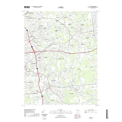
2019 Map of Lanham
USGS Topo · Published 2019About this map
The suburban landscape of Prince George's County is captured here, centered on the expansion of communities between Greenbelt and Bowie. The map highlights a dense network of residential developments and historic centers like Glenn Dale and Lanham, interwoven with the upper reaches of the Western Branch Patuxent River. Significant aviation infrastructure is visible at Freeway Airport, while the proximity to the federal research hub at Goddard influenced the growth of nearby neighborhoods such as Seabrook Acres. Local history is anchored by several long-standing religious sites and their associated grounds, including Saint Georges Episcopal Chapel Cem and Holy Trinity Episcopal Church Cem. The terrain is characterized by gentle ridges like Bald Hill and drainage systems such as Beaverdam Creek, which dictated early settlement patterns before modern road networks dominated the area.
Find a feature on this map
70 named features on this map. Tap any name to fly to it.
Don’t see what you’re looking for? This feature index may not catch every label — zoom into the map to look around manually.
Map Details
Editions of this 2019 Lanham Map
This is the sole edition of this map. No revisions or reprints were ever made.
Other maps of this area

1892 · Laurel
USGS Topo · 1:62,500

1892 · Owensville
USGS Topo · 1:62,500

1894 · Laurel
USGS Topo · 1:62,500

1894 · Relay
USGS Topo · 1:62,500

1895 · Owensville
USGS Topo · 1:62,500

1897 · Laurel
USGS Topo · 1:62,500

1899 · Patuxent
USGS Topo · 1:125,000

1900 · Washington
USGS Topo · 1:62,500

1905 · Owensville
USGS Topo · 1:62,500

1906 · Patuxent
USGS Topo · 1:125,000