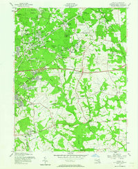
1957 Map of Lanham
USGS Topo · Published 1964About this map
Glenn Dale Sanatorium stands as a prominent landmark in this mid-century landscape of Prince George's County, situated near the Pennsylvania Railroad corridor. The area shows a transition from agricultural research to suburban expansion, anchored by the U.S. Department of Agriculture Research Center and the Plant Introduction Gardens. Residential clusters like Seabrook Acres, Hynesboro, and Carrollton are established alongside older institutional sites such as the Divine Savior Seminary and the Radio Station (WWV). Local infrastructure is marked by the Hillmeade Lookout tower and the intersection of major thoroughfares like the Baltimore-Washington Parkway and George Palmer Highway. Numerous community centers including Holy Trinity Ch and Ridgley Sch reflect the growth of these Maryland suburbs during the 1950s.
Find a feature on this map
99 named features on this map. Tap any name to fly to it.
Don’t see what you’re looking for? This feature index may not catch every label — zoom into the map to look around manually.
Map Details
Editions of this 1957 Lanham Map
2 editions found
Other maps of this area

1892 · Laurel
USGS Topo · 1:62,500

1892 · Owensville
USGS Topo · 1:62,500

1894 · Laurel
USGS Topo · 1:62,500

1894 · Relay
USGS Topo · 1:62,500

1895 · Owensville
USGS Topo · 1:62,500

1897 · Laurel
USGS Topo · 1:62,500

1899 · Patuxent
USGS Topo · 1:125,000

1900 · Washington
USGS Topo · 1:62,500

1905 · Owensville
USGS Topo · 1:62,500

1906 · Patuxent
USGS Topo · 1:125,000