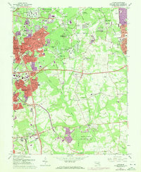
1965 Map of Lanham
USGS Topo · Published 1972About this map
The Goddard Space Flight Center (NASA) and the Agriculture Research Center anchor the northern landscape of this Prince George's County survey. Captured during a period of rapid suburban expansion, the map shows the transition from rural woodlands to organized residential developments like Greenwood Forest and Seabrook Acres. The infrastructure of the Cold War and the Space Age is evident, from the sprawl of federal research facilities to the Radio Station (WNAV).
Find a feature on this map
94 named features on this map. Tap any name to fly to it.
Don’t see what you’re looking for? This feature index may not catch every label — zoom into the map to look around manually.
Map Details
Editions of this 1965 Lanham Map
4 editions found
Other maps of this area

1892 · Laurel
USGS Topo · 1:62,500

1892 · Owensville
USGS Topo · 1:62,500

1894 · Laurel
USGS Topo · 1:62,500

1894 · Relay
USGS Topo · 1:62,500

1895 · Owensville
USGS Topo · 1:62,500

1897 · Laurel
USGS Topo · 1:62,500

1899 · Patuxent
USGS Topo · 1:125,000

1900 · Washington
USGS Topo · 1:62,500

1905 · Owensville
USGS Topo · 1:62,500

1906 · Patuxent
USGS Topo · 1:125,000