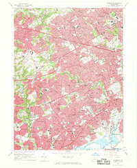
1967 Map of Lansdowne
USGS Topo · Published 1969About this map
Haverford and Upper Darby townships anchor this late-1960s suburban landscape, illustrating the dense residential expansion west of the Philadelphia line. The terrain is defined by the winding corridors of Crum Creek, Darby Creek, and Cobbs Creek, which serve as natural boundaries between established boroughs like Lansdowne, Clifton Heights, and Yeadon. The influence of institutional land use is prominent, with extensive grounds dedicated to Haverford State Hospital, Swarthmore College, and a concentration of large-scale burial grounds such as SS Peter and Paul Cemetery and Arlington Cemetery.
Find a feature on this map
160 named features on this map. Tap any name to fly to it.
Don’t see what you’re looking for? This feature index may not catch every label — zoom into the map to look around manually.
Map Details
Editions of this 1967 Lansdowne Map
4 editions found
Other maps of this area

1891 · Philadelphia
USGS Topo · 1:62,500

1893 · Germantown
USGS Topo · 1:62,500

1894 · Chester
USGS Topo · 1:62,500

1894 · Philadelphia
USGS Topo · 1:62,500

1894 · Norristown
USGS Topo · 1:62,500

1894 · Germantown
USGS Topo · 1:62,500

1895 · Norristown
USGS Topo · 1:62,500

1896 · Germantown
USGS Topo · 1:62,500

1896 · Philadelphia
USGS Topo · 1:62,500

1896 · Norristown
USGS Topo · 1:62,500