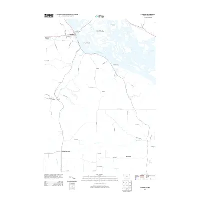
2013 Map of Lansing
USGS Topo · Published 2013About this map
Lansing stands as the primary riverfront settlement on this portion of the Mississippi River, anchored by the critical Black Hawk Bridge crossing into Wisconsin. The geography is defined by a complex network of backwaters and side channels, including Stevens Slough and Winneshiek Slough, which weave around substantial landforms like Island Number One Hundred Forty-three and Island Number One Hundred Forty-six. This intricate river system reflects the region's historical reliance on the water for both transport and industry.
Find a feature on this map
73 named features on this map. Tap any name to fly to it.
Don’t see what you’re looking for? This feature index may not catch every label — zoom into the map to look around manually.
Map Details
Editions of this 2013 Lansing Map
This is the sole edition of this map. No revisions or reprints were ever made.
Other maps of this area

1903 · Waukon
USGS Topo · 1:125,000

1929 · Ferryville
USGS Topo · 1:62,500

1929 · Prairie Du Chien
USGS Topo · 1:62,500

1932 · Ferryville
USGS Topo · 1:62,500

1932 · Prairie Du Chien
USGS Topo · 1:62,500

1958 · La Crosse
USGS Topo · 1:250,000

1961 · La Crosse
USGS Topo · 1:250,000

1965 · La Crosse
USGS Topo · 1:250,000

1966 · Ferryville
USGS Topo · 1:62,500
1967 · Prairie Du Chien
USGS Topo · 1:62,500