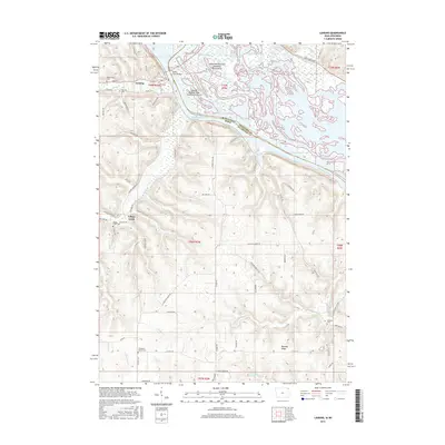
2015 Map of Lansing
USGS Topo · Published 2015About this map
Lansing stands as the primary riverfront settlement on this portion of the Mississippi River, where the Black Hawk Bridge crosses into Wisconsin. The landscape is defined by the contrast between the high bluffs of Allamakee County and the intricate network of channels and islands in the river basin, including Lake Winneshiek, Stevens Slough, and Winneshiek Bottoms. Inland, the terrain rises sharply into ridges and deep hollows, where smaller communities and family landmarks such as Mooney Ridge and Village Creek are situated.
Find a feature on this map
81 named features on this map. Tap any name to fly to it.
Don’t see what you’re looking for? This feature index may not catch every label — zoom into the map to look around manually.
Map Details
Editions of this 2015 Lansing Map
This is the sole edition of this map. No revisions or reprints were ever made.
Other maps of this area

1903 · Waukon
USGS Topo · 1:125,000

1929 · Ferryville
USGS Topo · 1:62,500

1929 · Prairie Du Chien
USGS Topo · 1:62,500

1932 · Ferryville
USGS Topo · 1:62,500

1932 · Prairie Du Chien
USGS Topo · 1:62,500

1958 · La Crosse
USGS Topo · 1:250,000

1961 · La Crosse
USGS Topo · 1:250,000

1965 · La Crosse
USGS Topo · 1:250,000

1966 · Ferryville
USGS Topo · 1:62,500
1967 · Prairie Du Chien
USGS Topo · 1:62,500