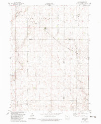
1982 Map of Lanyon
USGS Topo · Published 1983About this map
Paton anchors the southwestern corner of this survey, which captures the geometric agricultural landscape of the Iowa prairie at the dawn of the 1980s. The terrain is defined by the headwaters of East Buttrick Creek and Lost Grove Creek, where the natural drainage patterns compete with a rigid grid of section lines and field boundaries. The Chicago and North Western Railroad cuts diagonally across the northern half of the map, linking the small communities of Lanyon and Hope.
Find a feature on this map
19 named features on this map. Tap any name to fly to it.
Don’t see what you’re looking for? This feature index may not catch every label — zoom into the map to look around manually.
Map Details
Editions of this 1982 Lanyon Map
This is the sole edition of this map. No revisions or reprints were ever made.
Other maps of this area

1923 · Lehigh
USGS Topo · 1:62,500

1951 · Ogden
USGS Topo · 1:62,500

1954 · Fort Dodge
USGS Topo · 1:250,000

1957 · Fort Dodge
USGS Topo · 1:250,000

1958 · Fort Dodge
USGS Topo · 1:250,000

1962 · Jefferson
USGS Topo · 1:62,500

1965 · Lehigh
USGS Topo · 1:24,000

1965 · Gowrie
USGS Topo · 1:24,000

1965 · Harcourt
USGS Topo · 1:24,000
1982 · Ogden
USGS Topo · 1:24,000