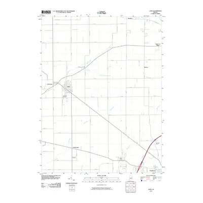
2010 Map of Lapel
USGS Topo · Published 2010About this map
Stony Creek winds southwest through the center of this landscape, connecting the clustered settlements of Bloomer, Lapel, and Fishersburg. The area exhibits a dense network of county roads following a rigid grid system, characteristic of central Indiana's agricultural and suburban development. Small residential enclaves and farming communities are scattered throughout, including Hardscrabble and Edgewood Village, while the larger town of Pendleton anchors the southeastern corner along Fall Crk. For family historians, the map is a significant record of local burial grounds, documenting the locations of the Old Woodward Cemetery, Brookside Cemetery, Nicholson Cemetery, and Pleasant Valley Cemetery. This 2010 survey also identifies Huntzinger Airport near the intersection of several major transit corridors, illustrating the region's continued reliance on local aviation and a well-developed road infrastructure.
Find a feature on this map
57 named features on this map. Tap any name to fly to it.
Don’t see what you’re looking for? This feature index may not catch every label — zoom into the map to look around manually.
Map Details
Editions of this 2010 Lapel Map
This is the sole edition of this map. No revisions or reprints were ever made.
Other maps of this area

1952 · Ingalls
USGS Topo · 1:24,000

1952 · Mc Cordsville
USGS Topo · 1:24,000

1952 · Anderson
USGS Topo · 1:24,000

1953 · Pendleton
USGS Topo · 1:24,000

1953 · Lapel
USGS Topo · 1:24,000

1953 · Riverwood
USGS Topo · 1:24,000

1953 · Cincinnati
USGS Topo · 1:250,000

1953 · Muncie
USGS Topo · 1:250,000

1956 · Muncie
USGS Topo · 1:250,000

1957 · Cincinnati
USGS Topo · 1:250,000