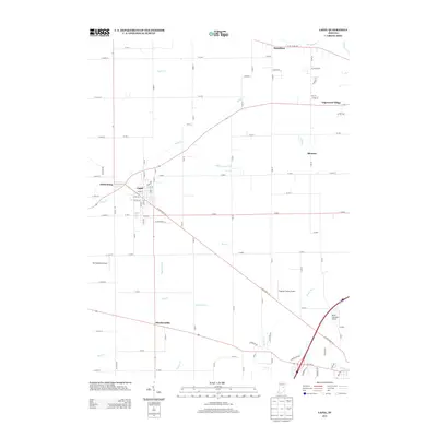
2013 Map of Lapel
USGS Topo · Published 2013About this map
The town of Lapel and the neighboring settlement of Fishersburg serve as the primary focal points of this 2013 Indiana survey, situated where Stony Cr winds through the agricultural landscape. The map captures a mix of traditional crossroads communities and small aviation fields, including Pat Robinson Airport and Foghorn Farms Airport. To the north, the White River cuts through the corner near the village of Hamilton, while the southern reaches are defined by a network of drainage systems like Kynett Ditch and Henry Ditch. This geography reflects the intensive land management common in central Indiana, where natural watercourses like Mud Cr and Thorpe Cr are integrated with engineered channels to support the surrounding farms. Local history is visible in the placement of outlying settlements such as Hardscrabble and Bloomer, which remain distinct landmarks within the rural grid.
Find a feature on this map
63 named features on this map. Tap any name to fly to it.
Don’t see what you’re looking for? This feature index may not catch every label — zoom into the map to look around manually.
Map Details
Editions of this 2013 Lapel Map
This is the sole edition of this map. No revisions or reprints were ever made.
Other maps of this area

1952 · Ingalls
USGS Topo · 1:24,000

1952 · Mc Cordsville
USGS Topo · 1:24,000

1952 · Anderson
USGS Topo · 1:24,000

1953 · Pendleton
USGS Topo · 1:24,000

1953 · Lapel
USGS Topo · 1:24,000

1953 · Riverwood
USGS Topo · 1:24,000

1953 · Cincinnati
USGS Topo · 1:250,000

1953 · Muncie
USGS Topo · 1:250,000

1956 · Muncie
USGS Topo · 1:250,000

1957 · Cincinnati
USGS Topo · 1:250,000