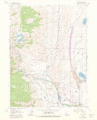
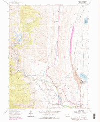
1962 Map of Laporte
USGS Topo · Published 1980About this map
The Cache La Poudre River flows through this Larimer County landscape, anchoring a complex system of water management and mountain ranching during the early 1960s. The settlement of Laporte and the nearby community of Bellvue serve as local hubs, where the Cache La Poudre School and the State Fish Hatchery mark the intersection of public services and the river economy. The terrain transitions from the high elevations of Bonner Peak and the Roosevelt National Forest to the managed waters of Seaman Reservoir and Miners Lake. Infrastructure dominates the valleys, with the Charles Hansen Feeder Canal and numerous tunnels illustrating the engineering required to move water through Pleasant Valley. Family heritage is visible in the landscape through named landmarks like McMurry Ranch, Coombs Ranch, and Teds Place, while local industry is represented by various Quarry sites and the Fort Collins Filtration Plant.
Find a feature on this map
37 named features on this map. Tap any name to fly to it.
Don’t see what you’re looking for? This feature index may not catch every label — zoom into the map to look around manually.
Map Details
Editions of this 1962 Laporte Map
5 editions found
Other maps of this area

1906 · Fort Collins
USGS Topo · 1:62,500

1907 · Livermore
USGS Topo · 1:125,000

1908 · Fort Collins
USGS Topo · 1:62,500

1909 · Livermore
USGS Topo · 1:125,000

1954 · Greeley
USGS Topo · 1:250,000

1957 · Greeley
USGS Topo · 1:250,000

1958 · Greeley
USGS Topo · 1:250,000

1960 · Livermore
USGS Topo · 1:24,000
1960 · Fort Collins
USGS Topo · 1:24,000
1960 · Buckeye
USGS Topo · 1:24,000