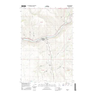
2017 Map of Lapwai
USGS Topo · Published 2017About this map
The Nez Perce National Historical Park anchors this portion of the Idaho panhandle, centered where the Clearwater River meets its tributaries. This landscape is defined by the sharp convergence of river valleys and high plateau benches, with the Potlatch River joining the Clearwater near Arrow. The settlement of Spalding sits at a critical bend in the river, adjacent to North Lapwai and the broader Lapwai Valley. Further south, the town of Lapwai serves as a hub for the local road network, which includes routes like Thunderhill Rd and Heritage Rd. The terrain is marked by numerous deep drainages such as Coyote Gulch, Soldiers Canyon, and Garden Gulch, illustrating the complex geography surrounding Mann Lake in the south. This survey detail captures the modern footprint of tribal lands and riverside communities established along these ancient waterways.
Find a feature on this map
76 named features on this map. Tap any name to fly to it.
Don’t see what you’re looking for? This feature index may not catch every label — zoom into the map to look around manually.
Map Details
Editions of this 2017 Lapwai Map
This is the sole edition of this map. No revisions or reprints were ever made.
Other maps of this area

1955 · Pullman
USGS Topo · 1:250,000

1958 · Pullman
USGS Topo · 1:250,000

1958 · Lapwai
USGS Topo · 1:24,000

1958 · Sweetwater
USGS Topo · 1:24,000

1958 · Lewiston Orchards North
USGS Topo · 1:24,000

1958 · Lewiston Orchards South
USGS Topo · 1:24,000

1958 · Lewiston Orchards
USGS Topo · 1:62,500

1958 · Culdesac
USGS Topo · 1:62,500

1961 · Kendrick
USGS Topo · 1:62,500

1961 · Moscow
USGS Topo · 1:62,500