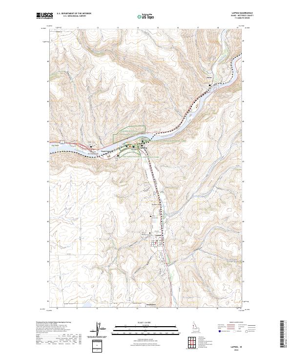
2024 Map of Lapwai
USGS Topo · Published 2024About this map
Nez Perce National Historical Park anchors this portion of northern Idaho, preserving the geography of the Lapwai Valley and the confluence of the Clearwater River and Potlatch River. The landscape is a vital cultural hub, centering on the town of Lapwai and the site of the Lapwai Mission. For genealogists, the map is remarkably dense with family-named burial grounds including the Bredell Family Cem, Broncheau Family Cem, and Grant Family Cem, alongside larger sites like the Spalding Cem and the Nez Perce Tribal Cem. Cultural landmarks such as The Ant and the Yellowjacket reflect the deep indigenous heritage of the region. The topography transitions from the river levels to high points like Thunder Hill, following the drainage patterns of Lapwai Creek and Tom Beall Creek.
Find a feature on this map
86 named features on this map. Tap any name to fly to it.
Don’t see what you’re looking for? This feature index may not catch every label — zoom into the map to look around manually.
Map Details
Editions of this 2024 Lapwai Map
This is the sole edition of this map. No revisions or reprints were ever made.
Other maps of this area

1955 · Pullman
USGS Topo · 1:250,000

1958 · Pullman
USGS Topo · 1:250,000

1958 · Lapwai
USGS Topo · 1:24,000

1958 · Sweetwater
USGS Topo · 1:24,000

1958 · Lewiston Orchards North
USGS Topo · 1:24,000

1958 · Lewiston Orchards South
USGS Topo · 1:24,000

1958 · Lewiston Orchards
USGS Topo · 1:62,500

1958 · Culdesac
USGS Topo · 1:62,500

1961 · Kendrick
USGS Topo · 1:62,500

1961 · Moscow
USGS Topo · 1:62,500