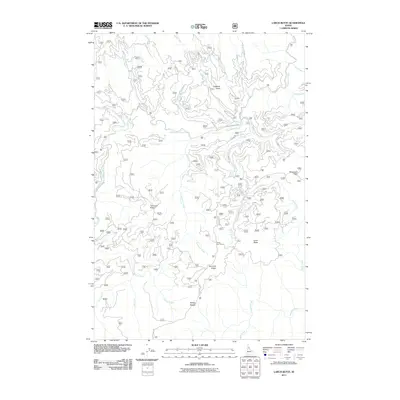
2011 Map of Larch Butte
USGS Topo · Published 2011About this map
Three Bear Camp sits at the heart of this mountainous Clearwater County landscape, serving as a focal point for the complex network of forest roads and ridges. The terrain is defined by prominent elevations such as Larch Butte and Gobblers Knob, with deep drainages formed by Orogrande Creek and its many tributaries. This 2011 survey reveals a landscape heavily utilized for forestry and backcountry access, evidenced by the intricate system of routes like French Mountain Rd and Shanghai Ridge Rd. The density of named ridges, including Tamarack Ridge and Hemlock Ridge, alongside numerous watercourses like Sylvan Creek and Knute Creek, provides a detailed record of the region's geographical nomenclature. Points of interest such as Sevenmile Point and Sylvan Saddle offer specific landmarks for navigating this densely wooded Idaho interior.
Find a feature on this map
35 named features on this map. Tap any name to fly to it.
Don’t see what you’re looking for? This feature index may not catch every label — zoom into the map to look around manually.
Map Details
Editions of this 2011 Larch Butte Map
This is the sole edition of this map. No revisions or reprints were ever made.
Other maps of this area

1911 · Lolo
USGS Topo · 1:250,000

1913 · Lolo
USGS Topo · 1:250,000

1923 · Washington Creek
USGS Topo · 1:125,000

1924 · Weippe
USGS Topo · 1:125,000

1956 · Hamilton
USGS Topo · 1:250,000

1959 · Hamilton
USGS Topo · 1:250,000

1960 · Hamilton
USGS Topo · 1:250,000

1963 · Clarke Mtn
USGS Topo · 1:24,000

1964 · Hamilton
USGS Topo · 1:250,000

1965 · Lean-to Point
USGS Topo · 1:24,000