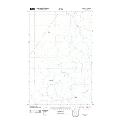
2011 Map of Laredo NE
USGS Topo · Published 2011About this map
Havre Irrigation Ditch and Beaver Creek define the agricultural water management system in this portion of Hill County. The landscape is marked by a series of distinct drainage patterns including Neuerth Coulee, South Fork Spring Coulee, and Herron Coulee, which illustrate the natural topography of the Montana plains. This 2011 survey reveals the intersection of irrigation infrastructure and natural watercourses, providing a clear record of the area's rural development and land use. The presence of Laredo Rd as a primary thoroughfare serves as a focal point for the sparse road network that traverses this section of the state, highlighting the wide spacing between developed corridors in the region.
Find a feature on this map
6 named features on this map. Tap any name to fly to it.
Don’t see what you’re looking for? This feature index may not catch every label — zoom into the map to look around manually.
Map Details
Editions of this 2011 Laredo NE Map
This is the sole edition of this map. No revisions or reprints were ever made.
Other maps of this area

1904 · Havre
USGS Topo · 1:62,500

1904 · Assinniboine
USGS Topo · 1:62,500

1912 · Thibedeau Lake
USGS Topo · 1:125,000

1953 · Havre
USGS Topo · 1:250,000

1957 · Havre
USGS Topo · 1:250,000

1958 · Havre
USGS Topo · 1:250,000

1959 · Laredo
USGS Topo · 1:62,500

1959 · Shambo
USGS Topo · 1:62,500

1964 · Havre
USGS Topo · 1:24,000
1970 · Herron Park
USGS Topo · 1:24,000