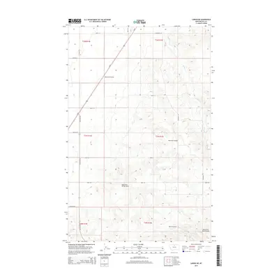
2014 Map of Laredo NE
USGS Topo · Published 2014About this map
Beaver Cr meanders through the eastern sections of this Hill County landscape, where the high plains of north-central Montana are cut by deep erosional coulees. In the south, Herron Coulee and South Fork Spring Coulee provide significant topographical relief, while Neuwerth Coulee stretches across the northern and central township boundaries. This 2014 survey documents a territory defined by large-scale agricultural and ranching divisions, evident in the rigid grid of numbered routes like Road 100 S and Road 415 S. Transportation through this area is anchored by the diagonal corridor of Us-87 and local thoroughfares such as Rocky Boy Rd and Assiniboine Rd, which navigate the complex drainage patterns of the Missouri River watershed north of the Bearpaw Mountains.
Find a feature on this map
22 named features on this map. Tap any name to fly to it.
Don’t see what you’re looking for? This feature index may not catch every label — zoom into the map to look around manually.
Map Details
Editions of this 2014 Laredo NE Map
This is the sole edition of this map. No revisions or reprints were ever made.
Other maps of this area

1904 · Havre
USGS Topo · 1:62,500

1904 · Assinniboine
USGS Topo · 1:62,500

1912 · Thibedeau Lake
USGS Topo · 1:125,000

1953 · Havre
USGS Topo · 1:250,000

1957 · Havre
USGS Topo · 1:250,000

1958 · Havre
USGS Topo · 1:250,000

1959 · Laredo
USGS Topo · 1:62,500

1959 · Shambo
USGS Topo · 1:62,500

1964 · Havre
USGS Topo · 1:24,000
1970 · Herron Park
USGS Topo · 1:24,000