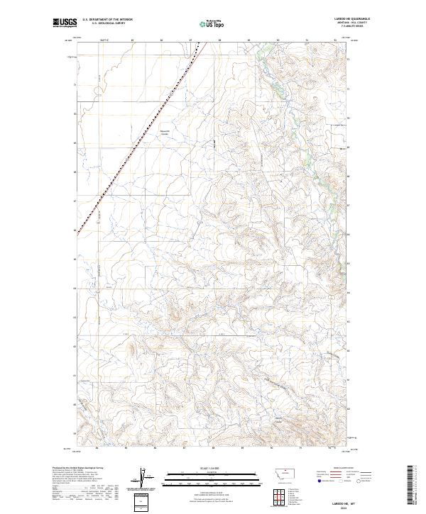
2024 Map of Laredo NE
USGS Topo · Published 2024About this map
Beaver Creek carves through the northern reaches of Hill County, defining the drainage patterns of this expansive Montana landscape. The terrain is deeply etched by a network of coulees, including Neuerth Coulee and Herron Coulee, which reveal the erosive work of water over this high plains environment. This modern survey illustrates the grid-based rural infrastructure typical of the region, where gravel and state routes like State Hwy 334 and Laredo Rd provide the primary connections between isolated homesteads and grazing lands. The topography is further marked by Spring Coulee and its South Fork Spring Coulee to the south, highlighting the complex seasonal hydrology that dictates land use in this part of the Big Sky Country. For those tracking land ownership or geographic changes, the map provides precise section lines across multiple townships, such as t31n r14e and t31n r15e.
Find a feature on this map
20 named features on this map. Tap any name to fly to it.
Don’t see what you’re looking for? This feature index may not catch every label — zoom into the map to look around manually.
Map Details
Editions of this 2024 Laredo NE Map
This is the sole edition of this map. No revisions or reprints were ever made.
Other maps of this area

1904 · Havre
USGS Topo · 1:62,500

1904 · Assinniboine
USGS Topo · 1:62,500

1912 · Thibedeau Lake
USGS Topo · 1:125,000

1953 · Havre
USGS Topo · 1:250,000

1957 · Havre
USGS Topo · 1:250,000

1958 · Havre
USGS Topo · 1:250,000

1959 · Laredo
USGS Topo · 1:62,500

1959 · Shambo
USGS Topo · 1:62,500

1964 · Havre
USGS Topo · 1:24,000
1970 · Herron Park
USGS Topo · 1:24,000