
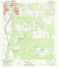
1979 Map of Laredo South
USGS Topo · Published 1980About this map
The Rio Bravo Grande defines the international boundary here, separating the growing urban centers of Laredo, Texas, and Nuevo Laredo, Tamaulipas. This late-1970s survey captures the border landscape just after the Treaty of 1970, showing the binational settlement patterns along the river valley. While the north bank is anchored by the Nat Guard Armory and the Octavio Sch, the south bank features a string of rural settlements including Echavarria, Santa Maria (Angelica), and Las Amapolas.
Find a feature on this map
27 named features on this map. Tap any name to fly to it.
Don’t see what you’re looking for? This feature index may not catch every label — zoom into the map to look around manually.
Map Details
Editions of this 1979 Laredo South Map
2 editions found
Other maps of this area

1933 · Becerra Creek
USGS Topo · 1:62,500

1956 · Islitas
USGS Topo · 1:62,500

1956 · Laredo East
USGS Topo · 1:62,500

1956 · Laredo
USGS Topo · 1:250,000

1965 · Laredo West
USGS Topo · 1:24,000

1965 · Tios Creek
USGS Topo · 1:24,000

1965 · Laredo East
USGS Topo · 1:24,000
1979 · Isla Mesteno
USGS Topo · 1:24,000

1979 · O'Keefe Lake
USGS Topo · 1:24,000

1980 · Blancas Creek North
USGS Topo · 1:24,000
Featured Places
- Laredo, TX
- La Presa, TX
- Tanquecitos South Acres Colonia, TX
- Larga Vista, Laredo
- Old Milwaukee West Colonia, TX