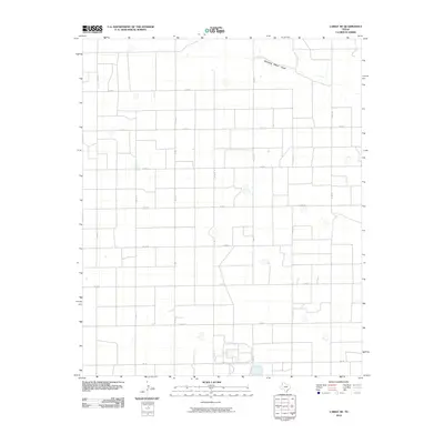
2010 Map of Lariat NE
USGS Topo · Published 2010About this map
Running Water Draw winds through the northern portion of this Parmer County landscape, a seasonal watercourse that provides one of the few natural breaks in an otherwise strictly partitioned agricultural grid. The map reveals a highly structured rural environment defined by a dense network of county roads, such as Co Rd 10 and Co Rd 12, which intersect at precise intervals to serve the surrounding farms. This systematic layout is characteristic of the High Plains, where land use is dictated by the availability of water and the efficiency of transport along routes like Fm 145. Scattered depressions and small intermittent basins across the terrain suggest the presence of playas, typical of this region's drainage patterns. The absence of named towns within the quadrangle emphasizes the purely agrarian nature of the area during the early 21st century.
Find a feature on this map
17 named features on this map. Tap any name to fly to it.
Don’t see what you’re looking for? This feature index may not catch every label — zoom into the map to look around manually.
Map Details
Editions of this 2010 Lariat NE Map
This is the sole edition of this map. No revisions or reprints were ever made.
Other maps of this area

1954 · Clovis
USGS Topo · 1:250,000

1958 · Clovis
USGS Topo · 1:250,000

1963 · Lariat
USGS Topo · 1:24,000

1963 · Clays Corner
USGS Topo · 1:24,000

1963 · Oklahoma Lane
USGS Topo · 1:24,000

1963 · Lariat NE
USGS Topo · 1:24,000

1963 · Lazbuddie SW
USGS Topo · 1:24,000

1963 · Progress
USGS Topo · 1:24,000

1965 · Bovina
USGS Topo · 1:24,000

1965 · Parmerton
USGS Topo · 1:24,000