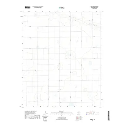
2019 Map of Lariat NE
USGS Topo · Published 2019About this map
Running Water Draw cuts across the northeastern corner of this West Texas landscape, marking the primary topographical break in an otherwise flat expanse of the Llano Estacado. The area is defined by a rigid section-line road network, where numbered county routes such as Co Rd 12 and Co Rd 16 create a precise geometric grid characteristic of modern industrial agriculture in Parmer County.
Find a feature on this map
18 named features on this map. Tap any name to fly to it.
Don’t see what you’re looking for? This feature index may not catch every label — zoom into the map to look around manually.
Map Details
Editions of this 2019 Lariat NE Map
This is the sole edition of this map. No revisions or reprints were ever made.
Other maps of this area

1954 · Clovis
USGS Topo · 1:250,000

1958 · Clovis
USGS Topo · 1:250,000

1963 · Lariat
USGS Topo · 1:24,000

1963 · Clays Corner
USGS Topo · 1:24,000

1963 · Oklahoma Lane
USGS Topo · 1:24,000

1963 · Lariat NE
USGS Topo · 1:24,000

1963 · Lazbuddie SW
USGS Topo · 1:24,000

1963 · Progress
USGS Topo · 1:24,000

1965 · Bovina
USGS Topo · 1:24,000

1965 · Parmerton
USGS Topo · 1:24,000