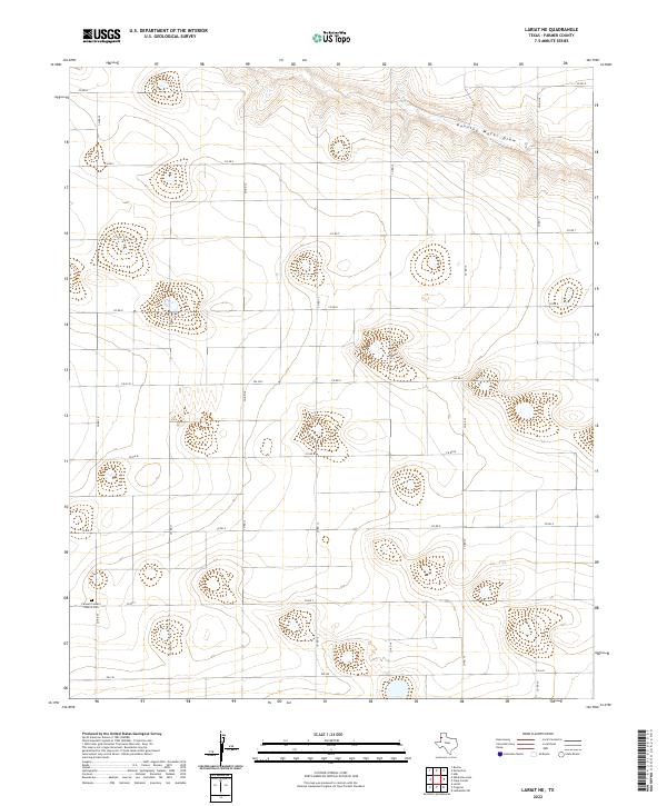
2022 Map of Lariat NE
USGS Topo · Published 2022About this map
Running Water Draw meanders across the northeastern corner of this High Plains landscape, cutting a distinct drainage path through an otherwise orderly grid of agricultural roads. This region of Parmer County is defined by its rural connectivity, where routes like Fm 3333 and Fm 145 link isolated farmsteads and local landmarks. A significant focal point for local history is the Farwell Country Church, situated alongside its associated Cem in the southwestern quadrant. This site serves as a vital touchstone for genealogical research in the area, marking a longstanding community center amidst the expansive fields of the Texas Panhandle. The map reveals the meticulous organization of the land, with numerous numbered roads such as Co RD 10 and Co RD R facilitating the movement of people and goods across this productive agricultural territory.
Find a feature on this map
20 named features on this map. Tap any name to fly to it.
Don’t see what you’re looking for? This feature index may not catch every label — zoom into the map to look around manually.
Map Details
Editions of this 2022 Lariat NE Map
This is the sole edition of this map. No revisions or reprints were ever made.
Other maps of this area

1954 · Clovis
USGS Topo · 1:250,000

1958 · Clovis
USGS Topo · 1:250,000

1963 · Lariat
USGS Topo · 1:24,000

1963 · Clays Corner
USGS Topo · 1:24,000

1963 · Oklahoma Lane
USGS Topo · 1:24,000

1963 · Lariat NE
USGS Topo · 1:24,000

1963 · Lazbuddie SW
USGS Topo · 1:24,000

1963 · Progress
USGS Topo · 1:24,000

1965 · Bovina
USGS Topo · 1:24,000

1965 · Parmerton
USGS Topo · 1:24,000