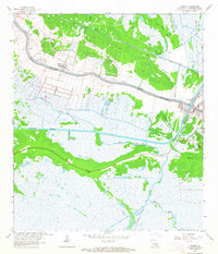
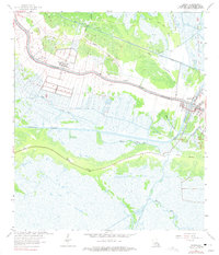
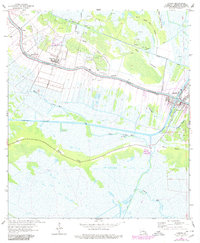
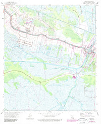
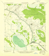
1963 Map of Larose
USGS Topo · Published 1964About this map
Bayou Lafourche dictates the settlement pattern of this coastal landscape, where narrow long-lot properties stretch back from the water in the traditional French arpent system. The communities of Valentine, Ludevine, and Larose line the banks, supported by a mix of agricultural and industrial activity in the early 1960s. The presence of Valentine Field and numerous labels for Oil Wells and Gas Wells underscore the region's mid-century petroleum economy.
Find a feature on this map
31 named features on this map. Tap any name to fly to it.
Don’t see what you’re looking for? This feature index may not catch every label — zoom into the map to look around manually.
Map Details
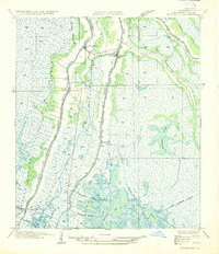
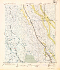
Editions of this 1963 Larose Map
4 editions found
Other maps of this area

1892 · Cut-Off
USGS Topo · 1:62,500

1892 · Houma
USGS Topo · 1:62,500

1894 · Lake Felicity
USGS Topo · 1:62,500

1894 · Dulac
USGS Topo · 1:62,500

1932 · Houma SE
USGS Topo · 1:31,680
1932 · Houma NE
USGS Topo · 1:31,680

1935 · Viguerie Canal
USGS Topo · 1:31,680
1935 · Montegut
USGS Topo · 1:31,680
1935 · Golden Meadow
USGS Topo · 1:31,680

1939 · Cut-Off
USGS Topo · 1:62,500