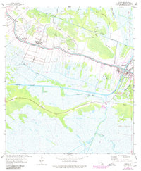
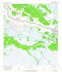
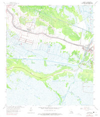
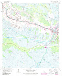
1963 Map of Larose
USGS Topo · Published 1980About this map
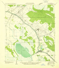
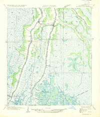
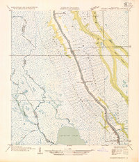
Bayou Lafourche serves as the primary artery for settlement and industry in this coastal Louisiana landscape, where narrow ribbon farms and linear communities like Valentine and Larose follow the high ground of the natural levee. The map reflects a mid-century economy built on the intersection of ancient waterways and modern extraction, with numerous gas and oil wells dotting the marshes and fields behind the settled front. The Southern Pacific railroad and the Intracoastal Waterway provide critical transportation infrastructure, cutting through a complex network of drainage features such as the Forty Arpent Canal and Grand Bayou Canal.
Find a feature on this map
29 named features on this map. Tap any name to fly to it.
Don’t see what you’re looking for? This feature index may not catch every label — zoom into the map to look around manually.
Map Details
Editions of this 1963 Larose Map
4 editions found
Other maps of this area

1892 · Cut-Off
USGS Topo · 1:62,500

1892 · Houma
USGS Topo · 1:62,500

1894 · Lake Felicity
USGS Topo · 1:62,500

1894 · Dulac
USGS Topo · 1:62,500

1932 · Houma SE
USGS Topo · 1:31,680
1932 · Houma NE
USGS Topo · 1:31,680

1935 · Viguerie Canal
USGS Topo · 1:31,680
1935 · Montegut
USGS Topo · 1:31,680
1935 · Golden Meadow
USGS Topo · 1:31,680

1939 · Cut-Off
USGS Topo · 1:62,500