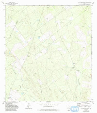
1972 Map of Las Escobas Ranch
USGS Topo · Published 1993About this map
The Zapata and Starr County boundary line cuts through this South Texas landscape, where the local economy and survival are defined by oil extraction and scarce water. Much of the activity is centered around the eponymous Las Escobas Ranch, with several windmills including La Precita Windmill and Paleta Windmill indicating the vital infrastructure needed for livestock in this arid environment.
Find a feature on this map
14 named features on this map. Tap any name to fly to it.
Don’t see what you’re looking for? This feature index may not catch every label — zoom into the map to look around manually.
Map Details
Editions of this 1972 Las Escobas Ranch Map
2 editions found
Other maps of this area

1938 · Falcon
USGS Topo · 1:62,500

1938 · El Sauz
USGS Topo · 1:62,500

1938 · Cuevitas
USGS Topo · 1:62,500

1949 · Mc Allen
USGS Topo · 1:250,000

1954 · McAllen
USGS Topo · 1:250,000

1956 · Arroyo Clareno
USGS Topo · 1:62,500

1957 · Mc Allen
USGS Topo · 1:250,000

1962 · McAllen
USGS Topo · 1:250,000

1965 · Salineno
USGS Topo · 1:24,000

1965 · Lopeno
USGS Topo · 1:24,000