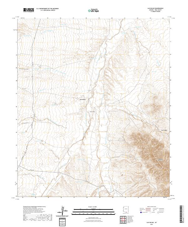
2021 Map of Las Guijas
USGS Topo · Published 2021About this map
Altar Valley serves as the central landscape of this Pima County region, where the drainages of the Las Guijas Mountains converge into a network of desert washes. Small ranching settlements like Secundino and Las Guijas dot the landscape, connected by the arterial routes of S Sasabe Rd and Arivaca Rd. The reliance on water management in this arid environment is evident through a high density of named stock tanks, including Tequila Tank, Lindberg Tank, and Boice Tank, which are strategically placed near natural watercourses such as Arivaca Wash and Santa Margarita Wash. This mapping reveals a sophisticated desert infrastructure designed for cattle and transit, with long-standing family and place names like Cordova Tank and Tiohuerrro Tank marking the territory. The convergence of Arivaca Cr and San Luis Wash in the southern reaches highlights the geographic importance of seasonal flow to the area's survival.
Find a feature on this map
40 named features on this map. Tap any name to fly to it.
Don’t see what you’re looking for? This feature index may not catch every label — zoom into the map to look around manually.
Map Details
Editions of this 2021 Las Guijas Map
This is the sole edition of this map. No revisions or reprints were ever made.
Other maps of this area

1920 · Arivaca
USGS Topo · 1:125,000

1940 · Palo Alto Ranch
USGS Topo · 1:62,500

1941 · Presumido Peak
USGS Topo · 1:62,500

1941 · Baboquivari Peak
USGS Topo · 1:62,500

1941 · Arivaca
USGS Topo · 1:62,500

1943 · Fresnal
USGS Topo · 1:125,000

1943 · Arivaca
USGS Topo · 1:62,500

1943 · Palo Alto Ranch
USGS Topo · 1:62,500

1943 · Presumido Peak
USGS Topo · 1:62,500

1944 · Baboquivari Peak
USGS Topo · 1:62,500