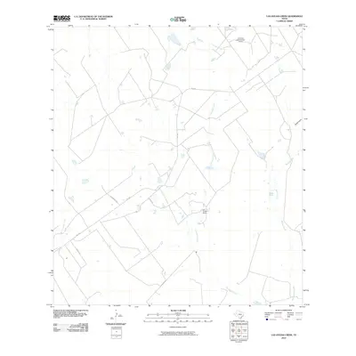
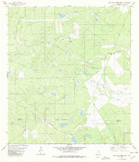
2010 Map of Las Ovejas Creek
USGS Topo · Published 2010About this map
Las Ovejas Ranch and the network of waterways that define the brush country of Zapata County are the central focus of this South Texas survey. The landscape is characterized by intermittent drainages including Las Ovejas Creek, Mulato Creek, and El Jara Creek, which support the regional ranching economy. Water management is a primary feature of the terrain, as evidenced by the L E Bruni Lake Number 3 Dam and Tasa Tank. The road network consists of state-maintained routes like FM 3169 and named local thoroughfares such as Louis Munoz Rd and Ovejas Rd, which provide access to family-held lands and newer developments like Garza Ests. This map illustrates the intersection of traditional Texas ranching heritage with modern land subdivision and infrastructure in the early twenty-first century.
Find a feature on this map
13 named features on this map. Tap any name to fly to it.
Don’t see what you’re looking for? This feature index may not catch every label — zoom into the map to look around manually.
Map Details
Editions of this 2010 Las Ovejas Creek Map
This is the sole edition of this map. No revisions or reprints were ever made.
Other maps of this area

1933 · Becerra Creek
USGS Topo · 1:62,500

1940 · Aguilares
USGS Topo · 1:62,500

1940 · Mogotes Hill
USGS Topo · 1:62,500

1942 · San Ygnacio
USGS Topo · 1:62,500

1956 · Mogotes Hill
USGS Topo · 1:62,500

1956 · Laredo
USGS Topo · 1:250,000
1980 · Mogotes Hill
USGS Topo · 1:24,000
1980 · Escobas
USGS Topo · 1:24,000
1980 · Agua Azul Creek East
USGS Topo · 1:24,000
1980 · Agua Azul Creek West
USGS Topo · 1:24,000