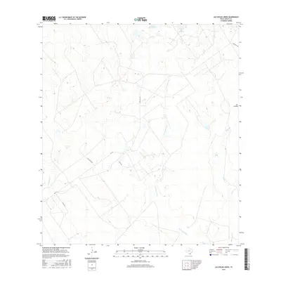
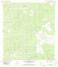
2016 Map of Las Ovejas Creek
USGS Topo · Published 2016About this map
Las Ovejas Creek defines this reach of the South Texas brush country, winding through a landscape of ranching infrastructure and intermittent watercourses. In this Zapata County quadrant, several family-named landmarks suggest the long-standing ranching heritage of the region, including Fred Bruni Rd and the managed waters of L E Bruni Lake Number 3 and L E Bruni Lake Number 4. The small settlement of Dos Arroyos sits on the eastern edge of the survey, where the drainages of Mulato Cr and other tributaries converge. Navigational arteries like Ranch Rd 3169 and Louis Munoz Rd provide access through the arid terrain, which is punctuated by essential water resources such as Tasa Tank. The presence of Garza Ests along the southern boundary reflects the gradual shift from large-scale ranching toward smaller rural land holdings.
Find a feature on this map
16 named features on this map. Tap any name to fly to it.
Don’t see what you’re looking for? This feature index may not catch every label — zoom into the map to look around manually.
Map Details
Editions of this 2016 Las Ovejas Creek Map
This is the sole edition of this map. No revisions or reprints were ever made.
Other maps of this area

1933 · Becerra Creek
USGS Topo · 1:62,500

1940 · Aguilares
USGS Topo · 1:62,500

1940 · Mogotes Hill
USGS Topo · 1:62,500

1942 · San Ygnacio
USGS Topo · 1:62,500

1956 · Mogotes Hill
USGS Topo · 1:62,500

1956 · Laredo
USGS Topo · 1:250,000
1980 · Mogotes Hill
USGS Topo · 1:24,000
1980 · Escobas
USGS Topo · 1:24,000
1980 · Agua Azul Creek East
USGS Topo · 1:24,000
1980 · Agua Azul Creek West
USGS Topo · 1:24,000