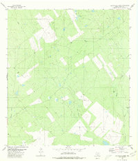
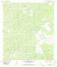
1980 Map of Las Ovejas Creek
USGS Topo · Published 1980About this map
Las Ovejas Creek winds through this Zapata County landscape, which by 1980 was defined by isolated ranching operations and nascent energy development. The presence of Las Ovejas Ranch and a nearby Corral indicate the enduring cattle heritage of the South Texas brush country, while scattered Drill Holes and a Gas Well signal the expansion of the oil and gas industry in the region. The map reveals an arid environment where water management was critical, evidenced by named features like Tortuga Tank and Tasa Tank. Drainage systems such as El Jaral Creek, Mulato Creek, and Cavanara Creek provide the primary geographic structure. A solitary Grave located near the ranch provides a poignant data point for local genealogists and historians tracing early families in this thinly populated borderlands territory.
Find a feature on this map
16 named features on this map. Tap any name to fly to it.
Don’t see what you’re looking for? This feature index may not catch every label — zoom into the map to look around manually.
Map Details
Editions of this 1980 Las Ovejas Creek Map
This is the sole edition of this map. No revisions or reprints were ever made.
Other maps of this area

1933 · Becerra Creek
USGS Topo · 1:62,500

1940 · Aguilares
USGS Topo · 1:62,500

1940 · Mogotes Hill
USGS Topo · 1:62,500

1942 · San Ygnacio
USGS Topo · 1:62,500

1956 · Mogotes Hill
USGS Topo · 1:62,500

1956 · Laredo
USGS Topo · 1:250,000
1980 · Mogotes Hill
USGS Topo · 1:24,000
1980 · Escobas
USGS Topo · 1:24,000
1980 · Agua Azul Creek East
USGS Topo · 1:24,000
1980 · Agua Azul Creek West
USGS Topo · 1:24,000