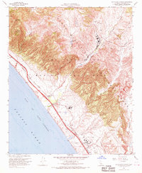
1968 Map of Las Pulgas Canyon
USGS Topo · Published 1970About this map
The coastal hills and military installations of Camp Pendleton Marine Corps Base define this 1960s coastal survey. The landscape is a mix of active defense infrastructure and deep history, most notably the Asistencia de Las Flores (Ruins) located near the Las Flores settlement area. The coastline is dominated by the twin transportation arteries of the San Diego Freeway and the Atchison Topeka and Santa Fe railroad, which run parallel to the Gulf of Santa Catalina. Inland, the terrain rises sharply toward San Onofre Mtn and Horno Hill, carved by complex drainages like Las Pulgas Canyon and Piedra de Lumbre Canyon. These canyons are utilized for military training, marked by numerous Firing Ranges and observation posts. Near the mouth of the Santa Margarita River, the Stuart Mesa area contains a Fire Sta and a Gaging Station (BM 48) along the railroad tracks.
Find a feature on this map
37 named features on this map. Tap any name to fly to it.
Don’t see what you’re looking for? This feature index may not catch every label — zoom into the map to look around manually.
Map Details
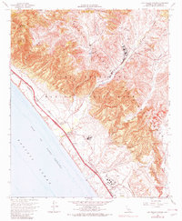
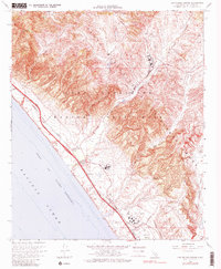
Editions of this 1968 Las Pulgas Canyon Map
3 editions found
Other maps of this area

1893 · Oceanside
USGS Topo · 1:62,500

1898 · Oceanside
USGS Topo · 1:62,500

1901 · Oceanside
USGS Topo · 1:62,500

1901 · San Luis Rey
USGS Topo · 1:125,000

1902 · Capistrano
USGS Topo · 1:125,000

1904 · Southern California Sheet No. 2
USGS Topo · 1:250,000

1906 · Capistrano
USGS Topo · 1:125,000

1941 · Margarita Peak
USGS Topo · 1:62,500

1942 · Margarita Peak
USGS Topo · 1:62,500

1942 · San Juan Capistrano
USGS Topo · 1:62,500
Featured Places
- Marine Corps Base Camp Pendleton, CA
- Las Flores, Marine Corps Base Camp Pendleton
- San Diego County, CA
- United States
- California