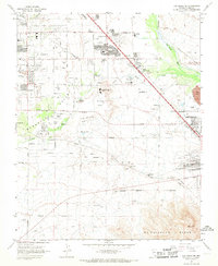
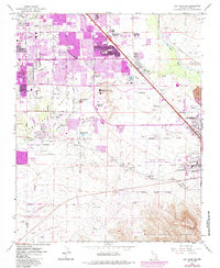
1967 Map of Las Vegas SE
USGS Topo · Published 1968About this map
Paradise Valley and the expanding southeastern fringes of the Las Vegas valley are captured here during a period of significant suburban and industrial transition. The landscape is a study in contrasts, where the natural drainage of Duck Creek and Las Vegas Wash meets the rising residential developments around East Las Vegas and Pittman. Much of the central area is dominated by the prominent landform of Whitney Mesa, while to the south, the industrial character of Henderson is clearly defined by its Industrial Area, extensive Gravel Pits, and large Tailings Ponds.
Find a feature on this map
39 named features on this map. Tap any name to fly to it.
Don’t see what you’re looking for? This feature index may not catch every label — zoom into the map to look around manually.
Map Details
Editions of this 1967 Las Vegas SE Map
5 editions found
Other maps of this area

1886 · Camp Mohave
USGS Topo · 1:250,000

1886 · Saint Thomas
USGS Topo · 1:250,000

1892 · Camp Mohave
USGS Topo · 1:250,000

1893 · Saint Thomas
USGS Topo · 1:250,000

1907 · Las Vegas
USGS Topo · 1:250,000

1908 · Las Vegas
USGS Topo · 1:250,000

1910 · Ivanpah
USGS Topo · 1:250,000

1912 · Ivanpah
USGS Topo · 1:250,000

1926 · Nelson
USGS Topo · 1:96,000

1926 · Boulder Canyon
USGS Topo · 1:96,000