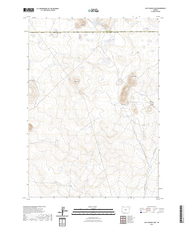
2024 Map of Last Chance Lake
USGS Topo · Published 2024About this map
Last Chance Lake and Paiute Lake define the northern portion of this high desert landscape along the border of Lake and Deschutes counties. The terrain is characterized by isolated volcanic rises, including the prominent Dog Butte and Saddle Butte, which stand above the surrounding basins. A network of ephemeral water features like Chewaucan Slough suggests a landscape shaped by seasonal hydrology and desert drainage patterns. This 2024 survey captures the region's sparse infrastructure, dominated by the remote Fredrick Butte Rd winding through the southeast. The lack of established settlements reflects the area's character as open rangeland, where topographic landmarks like Trail Butte likely served as vital orientation points for early travelers and land surveyors tracking the township and range lines.
Find a feature on this map
15 named features on this map. Tap any name to fly to it.
Don’t see what you’re looking for? This feature index may not catch every label — zoom into the map to look around manually.
Map Details
Editions of this 2024 Last Chance Lake Map
This is the sole edition of this map. No revisions or reprints were ever made.
Other maps of this area

1955 · Crescent
USGS Topo · 1:250,000

1957 · Crescent
USGS Topo · 1:250,000

1958 · Crescent
USGS Topo · 1:250,000

1970 · Crescent
USGS Topo · 1:250,000

1981 · Mean Rock Well
USGS Topo · 1:24,000

1982 · Peters Creek Sink
USGS Topo · 1:24,000

1982 · Jacks Place
USGS Topo · 1:24,000
1983 · Soldiers Cap
USGS Topo · 1:24,000

1983 · Imperial Valley South
USGS Topo · 1:24,000
1983 · Last Chance Lake
USGS Topo · 1:24,000