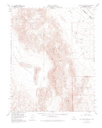
1958 Map of Last Chance Range
USGS Topo · Published 1976About this map
The Last Chance Range dominates the center of this 1950s survey, marking a stark divide between the Eureka Valley to the west and Death Valley to the east. The map captures a high-desert environment defined by extreme relief, where the northern reaches of the Death Valley National Monument meet the Nevada border. Rare water sources are carefully noted, including Sand Spr and Little Sand Spring, which served as vital landmarks for those traversing these basins.
Find a feature on this map
21 named features on this map. Tap any name to fly to it.
Don’t see what you’re looking for? This feature index may not catch every label — zoom into the map to look around manually.
Map Details
Editions of this 1958 Last Chance Range Map
3 editions found

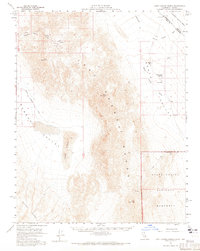
Other maps of this area

1908 · Lida
USGS Topo · 1:250,000

1908 · Ballarat
USGS Topo · 1:250,000

1913 · Lida
USGS Topo · 1:250,000

1913 · Ballarat
USGS Topo · 1:250,000

1948 · Death Valley
USGS Topo · 1:250,000

1951 · Waucoba Wash
USGS Topo · 1:62,500

1954 · Death Valley
USGS Topo · 1:250,000

1954 · Goldfield
USGS Topo · 1:250,000

1955 · Goldfield
USGS Topo · 1:250,000

1956 · Death Valley
USGS Topo · 1:250,000