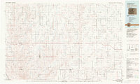
1983 Map of Last Chance
USGS Topo · Published 1983About this map
Last Chance and the surrounding high plains of Eastern Colorado appear here as a landscape defined by expansive ranching and agriculture, surveyed at a time when the region was networked by rural hamlets and small crossroads. The map documents the convergence of several county lines, including Adams, Arapahoe, Washington, and Elbert, illustrating how these administrative boundaries intersect the natural drainage basins. Water sources are critical features in this arid terrain, with Arickaree Creek and its north and west forks cutting across the eastern half, while Cottonwood Valley and Badger Creek define the western reaches. Scattered small settlements such as Lindon, Anton, and Woodrow serve as the primary human hubs, connected by a grid of rural roads and punctuated by functional landmarks like a series of remote Landing Strips.
Find a feature on this map
37 named features on this map. Tap any name to fly to it.
Don’t see what you’re looking for? This feature index may not catch every label — zoom into the map to look around manually.
Map Details
Editions of this 1983 Last Chance Map
This is the sole edition of this map. No revisions or reprints were ever made.
Other maps of this area

1891 · Limon
USGS Topo · 1:125,000

1892 · Limon
USGS Topo · 1:125,000

1950 · Hoyt
USGS Topo · 1:24,000

1951 · Hoyt
USGS Topo · 1:24,000

1951 · Leader SE
USGS Topo · 1:24,000

1951 · Leader
USGS Topo · 1:24,000

1953 · Denver
USGS Topo · 1:250,000

1954 · Limon
USGS Topo · 1:250,000

1954 · Sterling
USGS Topo · 1:250,000

1954 · Greeley
USGS Topo · 1:250,000