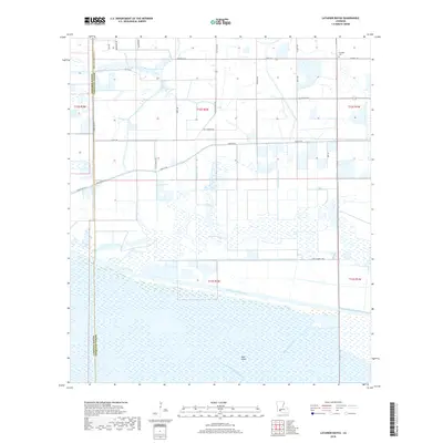
2018 Map of Latanier Bayou
USGS Topo · Published 2018About this map
The marshlands of the Cameron and Vermilion Parish border are defined by a complex network of drainage and transportation waterways. Central to the landscape is the namesake Latanier Bayou, which winds through a region heavily modified by early 20th-century engineering projects. The massive east-west corridor of the Intracoastal Waterway cuts through the southern portion of the quadrangle, facilitating coastal transit. To the north, a system of artificial channels including Gueydan Canal, Canal Number Four, and Canal Number Two illustrate the reclamation and agricultural management of the low-lying terrain. While much of the area consists of wetlands, local history is anchored by sites like the Gueydan Cem near the northern boundary. Transportation is limited to a grid of rural routes such as Ellis Bridge Rd and Spencer Rd, which navigate the reclaimed lands and connect family farmsteads scattered across the township and range sections.
Find a feature on this map
36 named features on this map. Tap any name to fly to it.
Don’t see what you’re looking for? This feature index may not catch every label — zoom into the map to look around manually.
Map Details
Editions of this 2018 Latanier Bayou Map
This is the sole edition of this map. No revisions or reprints were ever made.
Other maps of this area

1946 · Morse
USGS Topo · 1:31,680

1946 · Lake Arthur
USGS Topo · 1:31,680

1946 · Schooner Bayou NW
USGS Topo · 1:31,680

1946 · Schooner Bayou SW
USGS Topo · 1:31,680

1949 · Gueydan
USGS Topo · 1:31,680

1952 · Lake Charles
USGS Topo · 1:250,000

1953 · Jacks Point Island
USGS Topo · 1:24,000

1954 · Grand Lake East NW
USGS Topo · 1:31,680

1954 · Grand Lake East SE
USGS Topo · 1:31,680
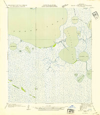
1954 · Grand Lake East SW
USGS Topo · 1:31,680