
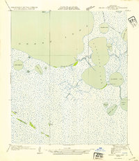
1979 Map of Latanier Bayou
USGS Topo · Published 1980About this map
Latanier Bayou meanders through a landscape defined by hydraulic engineering and energy extraction along the boundary of Cameron and Vermilion Parishes. In the late 1970s, this region of coastal Louisiana shows a complex network of artificial waterways, including the Intracoastal Waterway and various numbered irrigation and drainage routes like No 6 Canal and No 8 Canal. The map reveals the imprint of the petroleum industry with numerous Oil Wells scattered across the northern sections, while the southern reaches descend into the marshy terrain of Deer Island. Small centers of local activity such as Florence Landing and the Gueydan Cem serve as critical landmarks for genealogists and local historians tracking family ties to these wetlands. The presence of the Stanolind road and canals like Spencer Canal reflects the transition from natural bayous to a managed industrial and agricultural environment.
Find a feature on this map
18 named features on this map. Tap any name to fly to it.
Don’t see what you’re looking for? This feature index may not catch every label — zoom into the map to look around manually.
Map Details
Editions of this 1979 Latanier Bayou Map
This is the sole edition of this map. No revisions or reprints were ever made.
Other maps of this area

1946 · Morse
USGS Topo · 1:31,680

1946 · Lake Arthur
USGS Topo · 1:31,680

1946 · Schooner Bayou NW
USGS Topo · 1:31,680

1946 · Schooner Bayou SW
USGS Topo · 1:31,680

1949 · Gueydan
USGS Topo · 1:31,680

1952 · Lake Charles
USGS Topo · 1:250,000

1953 · Jacks Point Island
USGS Topo · 1:24,000

1954 · Grand Lake East NW
USGS Topo · 1:31,680

1954 · Grand Lake East SE
USGS Topo · 1:31,680
1954 · Grand Lake East SW
USGS Topo · 1:31,680