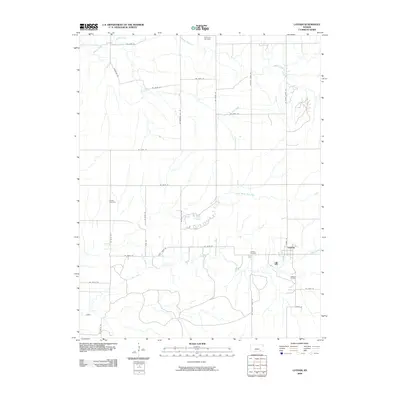
2009 Map of Latham
USGS Topo · Published 2009About this map
Latham serves as the primary settlement in this corner of Butler County, situated where a network of rural roads meets the Latham Oil Field. The landscape is defined by the branching tributaries of the Walnut River basin, including the wandering paths of Hickory Creek, Plum Creek, and Rock Creek. These waterways dictate the placement of local infrastructure and historical sites, such as Lake Clymer and the widely dispersed Brownlow Cemetery, Bryant Cemetery, and Latham Cemetery.
Find a feature on this map
36 named features on this map. Tap any name to fly to it.
Don’t see what you’re looking for? This feature index may not catch every label — zoom into the map to look around manually.
Map Details
Editions of this 2009 Latham Map
This is the sole edition of this map. No revisions or reprints were ever made.
Other maps of this area

1888 · Eldorado
USGS Topo · 1:125,000

1889 · Burden
USGS Topo · 1:125,000

1955 · Wichita
USGS Topo · 1:250,000

1958 · Wichita
USGS Topo · 1:250,000

1963 · Leon
USGS Topo · 1:24,000

1964 · Augusta SE
USGS Topo · 1:24,000

1964 · Beaumont
USGS Topo · 1:24,000

1964 · Latham
USGS Topo · 1:24,000

1964 · Cambridge NW
USGS Topo · 1:24,000
1964 · Keighley
USGS Topo · 1:24,000