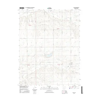
2015 Map of Latham
USGS Topo · Published 2015About this map
Latham serves as the primary settlement on this sheet, situated at the intersection of Cherry St, W Blaine St, and Walnut St. This area of Butler County is defined by its intricate drainage patterns, with the headwaters of Rock Creek and its tributary North Branch Rock Creek flowing south of Lake Clymer. The landscape is etched with local history, evidenced by family and local burial grounds like Brownlow Cemetery in the north and Bryant Cemetery to the west. Roads such as Douglas-Latham Road and Latham-Beaumont Road connect this agricultural hub to neighboring districts, following the section lines that divide the townships of t28s r6e, t28s r7e, t29s r6e, and t29s r7e. Water is a constant presence, from the northern flows of Hickory Creek to the central path of Plum Creek.
Find a feature on this map
44 named features on this map. Tap any name to fly to it.
Don’t see what you’re looking for? This feature index may not catch every label — zoom into the map to look around manually.
Map Details
Editions of this 2015 Latham Map
This is the sole edition of this map. No revisions or reprints were ever made.
Other maps of this area

1888 · Eldorado
USGS Topo · 1:125,000

1889 · Burden
USGS Topo · 1:125,000

1955 · Wichita
USGS Topo · 1:250,000

1958 · Wichita
USGS Topo · 1:250,000

1963 · Leon
USGS Topo · 1:24,000

1964 · Augusta SE
USGS Topo · 1:24,000

1964 · Beaumont
USGS Topo · 1:24,000

1964 · Latham
USGS Topo · 1:24,000

1964 · Cambridge NW
USGS Topo · 1:24,000
1964 · Keighley
USGS Topo · 1:24,000