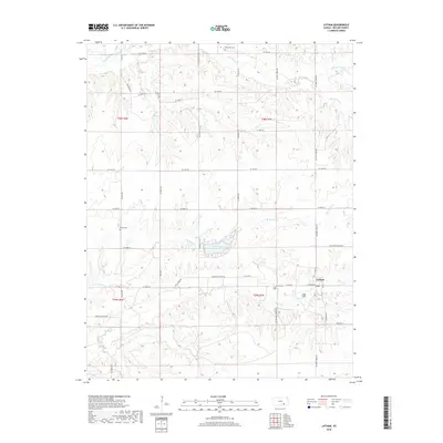
2018 Map of Latham
USGS Topo · Published 2018About this map
Latham serves as the central hub of this Butler County landscape, situated at the intersection of Latham-Beaumont Rd and Douglas-Latham Rd. The town's local history is anchored by the Latham Cem on its western edge, while outlying rural burials at Brownlow Cem to the north and Bryant Cem to the west trace the early settlement patterns of the region. The drainage network is particularly dense here, defined by the winding course of Rock Cr and its northern branch, alongside Satchel Creek and Plum Cr. These waterways create a highly dissected terrain that has dictated the grid-like placement of county roads. Lake Clymer provides a significant water feature in the central portion of the quadrangle, surrounded by the headwaters of numerous small creeks that feed into the larger prairie river systems.
Find a feature on this map
44 named features on this map. Tap any name to fly to it.
Don’t see what you’re looking for? This feature index may not catch every label — zoom into the map to look around manually.
Map Details
Editions of this 2018 Latham Map
This is the sole edition of this map. No revisions or reprints were ever made.
Other maps of this area

1888 · Eldorado
USGS Topo · 1:125,000

1889 · Burden
USGS Topo · 1:125,000

1955 · Wichita
USGS Topo · 1:250,000

1958 · Wichita
USGS Topo · 1:250,000

1963 · Leon
USGS Topo · 1:24,000

1964 · Augusta SE
USGS Topo · 1:24,000

1964 · Beaumont
USGS Topo · 1:24,000

1964 · Latham
USGS Topo · 1:24,000

1964 · Cambridge NW
USGS Topo · 1:24,000
1964 · Keighley
USGS Topo · 1:24,000