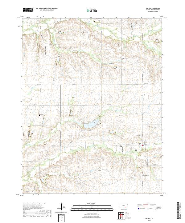
2022 Map of Latham
USGS Topo · Published 2022About this map
Latham serves as the primary settlement hub for this corner of Butler County, situated where Latham-Beaumont Rd and Douglas-Latham Rd intersect. The landscape is defined by the intricate dendritic drainage patterns of Rock Cr and its northern tributaries, including the impounded Lake Clymer. This modern survey details a rural environment where land use is dictated by the terrain, with roads like Munson Hill Rd and SE Stony Creek Rd tracing the high ground between creek beds. Genealogists and local historians can locate several dispersed burial sites that mark the area's pioneer heritage, such as Brownlow Cem in the north and Bryant Cem to the west, while Latham Cem sits just outside the town proper. The map provides a clear look at the contemporary township structure, including the transition between Township 28 South and Township 29 South.
Find a feature on this map
47 named features on this map. Tap any name to fly to it.
Don’t see what you’re looking for? This feature index may not catch every label — zoom into the map to look around manually.
Map Details
Editions of this 2022 Latham Map
This is the sole edition of this map. No revisions or reprints were ever made.
Other maps of this area

1888 · Eldorado
USGS Topo · 1:125,000

1889 · Burden
USGS Topo · 1:125,000

1955 · Wichita
USGS Topo · 1:250,000

1958 · Wichita
USGS Topo · 1:250,000

1963 · Leon
USGS Topo · 1:24,000

1964 · Augusta SE
USGS Topo · 1:24,000

1964 · Beaumont
USGS Topo · 1:24,000

1964 · Latham
USGS Topo · 1:24,000

1964 · Cambridge NW
USGS Topo · 1:24,000
1964 · Keighley
USGS Topo · 1:24,000