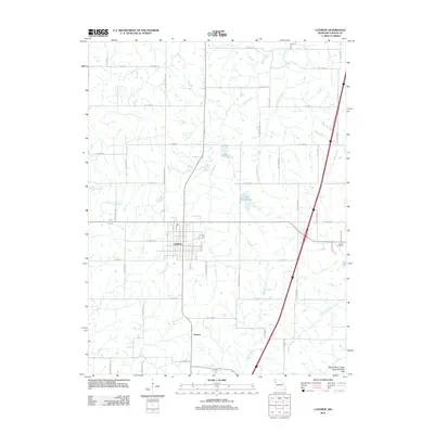
2012 Map of Lathrop
USGS Topo · Published 2012About this map
The settlement of Lathrop serves as the primary hub of this 2012 survey, showing the grid-patterned streets of Park St, Pine St, and Elm St as they center the local community. The surrounding landscape of Clinton County is defined by the Grand River Loess Flats and Drift Hills, where a dense network of watercourses including Shoal Creek, Grindstone Creek, and the Muddy Fork carve through the agricultural terrain. To the south, the smaller settlement of Guyton sits near the crossing of these drainage patterns.
Find a feature on this map
55 named features on this map. Tap any name to fly to it.
Don’t see what you’re looking for? This feature index may not catch every label — zoom into the map to look around manually.
Map Details
Editions of this 2012 Lathrop Map
This is the sole edition of this map. No revisions or reprints were ever made.
Other maps of this area

1894 · Independence
USGS Topo · 1:125,000

1924 · Polo
USGS Topo · 1:62,500

1925 · Plattsburg
USGS Topo · 1:62,500

1936 · Kearney
USGS Topo · 1:48,000

1942 · Kearney
USGS Topo · 1:62,500

1945 · Kearney
USGS Topo · 1:62,500

1950 · Kansas City
USGS Topo · 1:250,000

1954 · Kansas City
USGS Topo · 1:250,000

1956 · Kansas City
USGS Topo · 1:250,000
1957 · Lawson
USGS Topo · 1:24,000