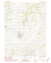
1984 Map of Lathrop
USGS Topo · Published 1984About this map
Lathrop serves as the central hub for this portion of Clinton County, shown here during the mid-1980s as a well-established rural community defined by its grid-pattern streets and local landmarks like the Radio Tower and Sewage Disposal Ponds. The landscape is a network of drainage systems and agricultural infrastructure, where the Muddy Fork and Crooked River converge near the small settlement of Converse to the south.
Find a feature on this map
20 named features on this map. Tap any name to fly to it.
Don’t see what you’re looking for? This feature index may not catch every label — zoom into the map to look around manually.
Map Details
Editions of this 1984 Lathrop Map
This is the sole edition of this map. No revisions or reprints were ever made.
Other maps of this area

1894 · Independence
USGS Topo · 1:125,000

1924 · Polo
USGS Topo · 1:62,500

1925 · Plattsburg
USGS Topo · 1:62,500

1936 · Kearney
USGS Topo · 1:48,000

1942 · Kearney
USGS Topo · 1:62,500

1945 · Kearney
USGS Topo · 1:62,500

1950 · Kansas City
USGS Topo · 1:250,000

1954 · Kansas City
USGS Topo · 1:250,000

1956 · Kansas City
USGS Topo · 1:250,000
1957 · Lawson
USGS Topo · 1:24,000