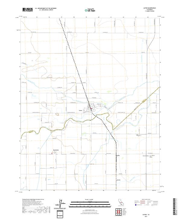
2021 Map of Laton
USGS Topo · Published 2021About this map
Laton sits at the heart of this agricultural landscape within the San Joaquin Valley, where the Kings River and its various distributaries define the local geography. The map illustrates a complex network of water management essential to the region's productivity, featuring several man-made and natural waterways such as Murphy Slough, Riverside Ditch, and Last Chance Ditch. These irrigation features intertwine with the primary river channel, supporting the surrounding farmlands and small community centers.
Find a feature on this map
77 named features on this map. Tap any name to fly to it.
Don’t see what you’re looking for? This feature index may not catch every label — zoom into the map to look around manually.
Map Details
Editions of this 2021 Laton Map
This is the sole edition of this map. No revisions or reprints were ever made.
Other maps of this area

1924 · Riverdale
USGS Topo · 1:31,680

1924 · Selma
USGS Topo · 1:31,680

1924 · Conejo
USGS Topo · 1:31,680

1925 · Caruthers
USGS Topo · 1:31,680

1926 · Hanford
USGS Topo · 1:31,680

1926 · Burris Park
USGS Topo · 1:31,680

1927 · Laton
USGS Topo · 1:31,680

1927 · Remnoy
USGS Topo · 1:31,680

1927 · Riverdale
USGS Topo · 1:31,680

1927 · Lemoore
USGS Topo · 1:31,680