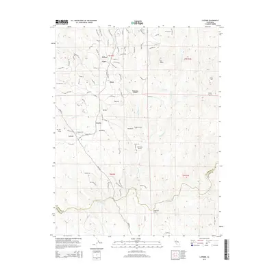
2015 Map of Latrobe
USGS Topo · Published 2015About this map
Latrobe sits as a central junction within this El Dorado County landscape, where the historic El Dorado Trail and S Shingle Rd meet. The settlement patterns reflect the region's diverse heritage, notably marked by the Chinese Cemetery near China Mtn, providing a direct link to the immigrant labor history of the California foothills. Small, named locales like Bullard, Dugan, and Shrub are scattered across the terrain, connected by a network of rural roads such as Double Oak Rd and Haveture Rd. The southern portion of the map is defined by the Cosumnes River, which forms the natural boundary between El Dorado and Amador counties. Water management history is evident in features like the Michigan Bar Ditch, while the surrounding topography is punctuated by landmarks such as Sugarloaf, Ben Bolt Ridge, and the White Man Ravine.
Find a feature on this map
86 named features on this map. Tap any name to fly to it.
Don’t see what you’re looking for? This feature index may not catch every label — zoom into the map to look around manually.
Map Details
Editions of this 2015 Latrobe Map
This is the sole edition of this map. No revisions or reprints were ever made.
Other maps of this area

1889 · Jackson
USGS Topo · 1:125,000

1891 · Sacramento
USGS Topo · 1:125,000

1891 · Placerville
USGS Topo · 1:125,000

1892 · Jackson
USGS Topo · 1:125,000

1892 · Sacramento
USGS Topo · 1:125,000

1892 · Placerville
USGS Topo · 1:125,000

1893 · Placerville
USGS Topo · 1:125,000

1893 · Sacramento
USGS Topo · 1:125,000

1894 · Lodi
USGS Topo · 1:125,000

1897 · Jackson
USGS Topo · 1:125,000