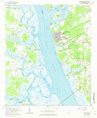
1962 Map of Laurel Bay
USGS Topo · Published 1972About this map
Laurel Bay (Naval Housing Area) dominates the landscape of Port Royal Island in this early 1960s study, showing a developed residential grid complete with Laurel Bay School and School No. 2. The surrounding Lowcountry terrain is defined by an intricate network of tidal waterways, including the wide Broad River and Whale Branch, which separate various islands like Barnwell Island and Cole Island. Genealogists will find several small burial grounds and houses of worship scattered through the rural sections, such as Republican Hall Cemetery near the Seaboard Air Line and Bethlehem Church. The map details a period when maritime and rail access remained vital to the area, evidenced by the Salvesburg Landing and the Atlantic Coast Line railroad cutting across the eastern wetlands near Grays Hill.
Find a feature on this map
74 named features on this map. Tap any name to fly to it.
Don’t see what you’re looking for? This feature index may not catch every label — zoom into the map to look around manually.
Map Details
Editions of this 1962 Laurel Bay Map
2 editions found
Other maps of this area

1918 · Green Pond
USGS Topo · 1:62,500

1918 · Yemassee
USGS Topo · 1:62,500

1920 · Okatie
USGS Topo · 1:62,500

1942 · Okatie
USGS Topo · 1:62,500

1943 · Yemassee
USGS Topo · 1:62,500

1943 · Green Pond
USGS Topo · 1:62,500

1944 · Fort Fremont
USGS Topo · 1:62,500

1947 · Savannah
USGS Topo · 1:250,000

1948 · Savannah
USGS Topo · 1:250,000
1956 · Parris Island
USGS Topo · 1:24,000