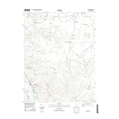
2013 Map of Laurel
USGS Topo · Published 2013About this map
The Ohio River forms the southwestern boundary of this landscape, where the borders of Campbell County, Kentucky, and Clermont County, Ohio, meet at the river's edge. This region is characterized by a series of small, scattered settlements such as Laurel, Nicholsville, and Clermontville that are connected by a network of state routes like Oh-222 and Oh-232. The terrain is deeply dissected by numerous waterways including Twelvemile Creek, Big Indian Creek, and Boat Run, which have carved notable features like Opossum Hollow. Local history is well-preserved through a high density of rural cemeteries, such as the Lindale Baptist Cemetery and Franklin Chapel Cemetery, which serve as markers of early family settlements. Along the riverfront, Armacosts Landing and the Mentor area illustrate the historical importance of river access to these upland communities.
Find a feature on this map
71 named features on this map. Tap any name to fly to it.
Don’t see what you’re looking for? This feature index may not catch every label — zoom into the map to look around manually.
Map Details
Editions of this 2013 Laurel Map
This is the sole edition of this map. No revisions or reprints were ever made.
Other maps of this area

1898 · East Cincinnati
USGS Topo · 1:62,500

1914 · East Cincinnati
USGS Topo · 1:62,500

1914 · Batavia
USGS Topo · 1:48,000

1916 · Batavia
USGS Topo · 1:62,500

1929 · Alexandria
USGS Topo · 1:48,000

1931 · Felicity
USGS Topo · 1:62,500

1936 · Alexandria
USGS Topo · 1:62,500

1953 · Laurel
USGS Topo · 1:24,000

1953 · Withamsville
USGS Topo · 1:24,000

1953 · Bethel
USGS Topo · 1:24,000