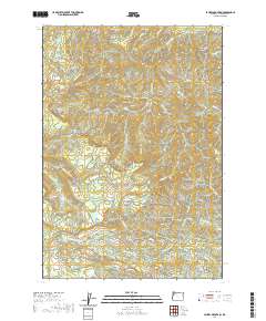
2020 Map of Laurel Mountain
USGS Topo · Published 2020About this map
Laurel Mountain and the high ridges of the Central Oregon Coast Range dominate this part of Polk County. The terrain is defined by a complex drainage system where the Little Luckiamute River and Rickreall Creek originate, flowing through steep canyons like Gorge Canyon and over landmarks such as Silver Falls. The map reveals an intensive network of logging and service roads, including Rickreall Road and Gold Creek Road, which provide access to the timber-rich elevations around Dorn Peak and Riley Peak. A notable concentration of springs and small tributaries, such as Boulder Springs and Bridge Forty Creek, emphasizes the importance of this watershed to the downstream valley. The presence of Boulder Pass and named ridges like Mule Tail Ridge and Mill Creek Ridge illustrates how the physical geography dictated early travel and modern resource management in these highlands.
Find a feature on this map
43 named features on this map. Tap any name to fly to it.
Don’t see what you’re looking for? This feature index may not catch every label — zoom into the map to look around manually.
Map Details
Editions of this 2020 Laurel Mountain Map
This is the sole edition of this map. No revisions or reprints were ever made.
Other maps of this area

1942 · Sheridan
USGS Topo · 1:62,500

1942 · Spirit Mtn
USGS Topo · 1:62,500

1942 · Valsetz
USGS Topo · 1:62,500

1942 · Dallas
USGS Topo · 1:62,500

1948 · Vancouver
USGS Topo · 1:250,000

1950 · Vancouver
USGS Topo · 1:250,000

1950 · Vancouver
USGS Topo · 1:250,000

1953 · Salem
USGS Topo · 1:250,000

1954 · Salem
USGS Topo · 1:250,000

1955 · Grand Ronde
USGS Topo · 1:62,500