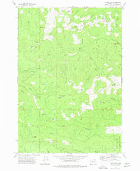
1974 Map of Laurel Mtn
USGS Topo · Published 1977About this map
Laurel Mountain dominates this mid-1970s landscape, serving as a focal point for a region defined by high-elevation ridges and deep creek drainages. The area is heavily managed for timber and conservation, evidenced by the extensive George T Gerlinger State Experimental Forest in the southeast and numerous extractive sites like Borrow Pits and quarries scattered across the slopes. The logging history of Polk County is written into the terrain through a network of pack trails, jeep trails, and a prominent Old RR Grade near Little Luckiamute R, marking the transition from rail-based timber hauling to modern road systems.
Find a feature on this map
47 named features on this map. Tap any name to fly to it.
Don’t see what you’re looking for? This feature index may not catch every label — zoom into the map to look around manually.
Map Details
Editions of this 1974 Laurel Mtn Map
This is the sole edition of this map. No revisions or reprints were ever made.
Other maps of this area

1942 · Sheridan
USGS Topo · 1:62,500

1942 · Spirit Mtn
USGS Topo · 1:62,500

1942 · Valsetz
USGS Topo · 1:62,500

1942 · Dallas
USGS Topo · 1:62,500

1948 · Vancouver
USGS Topo · 1:250,000

1950 · Vancouver
USGS Topo · 1:250,000

1950 · Vancouver
USGS Topo · 1:250,000

1953 · Salem
USGS Topo · 1:250,000

1954 · Salem
USGS Topo · 1:250,000

1955 · Grand Ronde
USGS Topo · 1:62,500