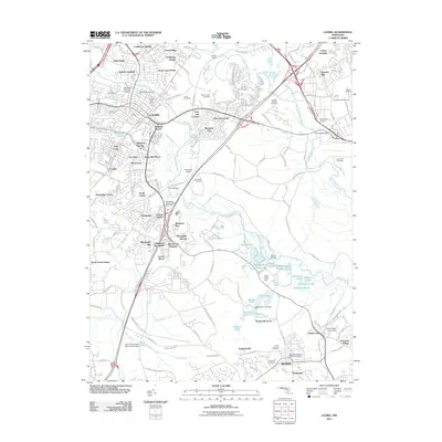
2011 Map of Laurel
USGS Topo · Published 2011About this map
The Patuxent River and Little Patuxent River converge in this densely detailed suburban landscape, where longstanding institutions meet modern residential growth. Historic sites like Snow Hill Manor and several burial grounds, including Ivy Hill Cemetery and Saint Mary of the Mill Cemetery, anchor the community's heritage. The map highlights the area's role as a regional transit and educational hub, featuring the Laurel Racetrack, Bowie State University, and the Suburban Airport. Ponds and lakes dot the terrain, from Cash Lake to the SCS Lake, often managed by structures like the Cash Creek Dam. This survey documents the intricate network of neighborhoods such as Steward Manor, Duckettsville, and Jericho Park, illustrating how the corridor between major Maryland centers developed into a complex mix of academic, recreational, and residential zones by the early 21st century.
Find a feature on this map
176 named features on this map. Tap any name to fly to it.
Don’t see what you’re looking for? This feature index may not catch every label — zoom into the map to look around manually.
Map Details
Editions of this 2011 Laurel Map
This is the sole edition of this map. No revisions or reprints were ever made.
Other maps of this area

1892 · Laurel
USGS Topo · 1:62,500

1892 · Owensville
USGS Topo · 1:62,500

1894 · Laurel
USGS Topo · 1:62,500

1894 · Relay
USGS Topo · 1:62,500

1895 · Owensville
USGS Topo · 1:62,500

1897 · Laurel
USGS Topo · 1:62,500

1899 · Patuxent
USGS Topo · 1:125,000

1900 · Washington
USGS Topo · 1:62,500

1905 · Owensville
USGS Topo · 1:62,500

1906 · Patuxent
USGS Topo · 1:125,000