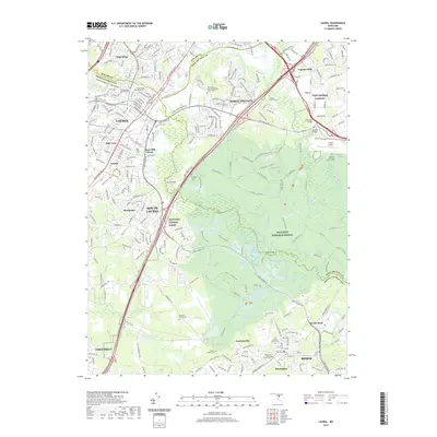
2019 Map of Laurel
USGS Topo · Published 2019About this map
The Patuxent River and its various tributaries, including the Little Patuxent River and Beaverdam Cr, shape the landscape between Laurel and Bowie. This 2019 survey documents a complex suburban and institutional corridor, anchored by the sprawling Patuxent Research Refuge and the military grounds of Fort George G Meade. The map provides significant genealogical value through its detailed labeling of local burial sites, such as the Ivy Hill Cem and Saint Mary of the Mill Cem, alongside family-named landmarks like the Snowden Family Cem.
Find a feature on this map
118 named features on this map. Tap any name to fly to it.
Don’t see what you’re looking for? This feature index may not catch every label — zoom into the map to look around manually.
Map Details
Editions of this 2019 Laurel Map
This is the sole edition of this map. No revisions or reprints were ever made.
Other maps of this area

1892 · Laurel
USGS Topo · 1:62,500

1892 · Owensville
USGS Topo · 1:62,500

1894 · Laurel
USGS Topo · 1:62,500

1894 · Relay
USGS Topo · 1:62,500

1895 · Owensville
USGS Topo · 1:62,500

1897 · Laurel
USGS Topo · 1:62,500

1899 · Patuxent
USGS Topo · 1:125,000

1900 · Washington
USGS Topo · 1:62,500

1905 · Owensville
USGS Topo · 1:62,500

1906 · Patuxent
USGS Topo · 1:125,000