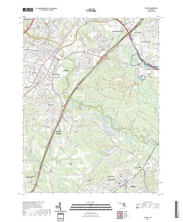
2023 Map of Laurel
USGS Topo · Published 2023About this map
The Little Patuxent River and the Patuxent River converge south of Fort Meade, framing a landscape defined by expansive institutional grounds and historic family burial sites. This 2023 survey illustrates the modern residential character of Laurel and South Laurel, while preserving the location of long-standing local landmarks like Snow Hill Manor and the Snowden Family Cem. To the east, the Patuxent Research Refuge encompasses a significant portion of the terrain, protecting wetland environments such as Knowles Marshes and Island Marshes.
Find a feature on this map
93 named features on this map. Tap any name to fly to it.
Don’t see what you’re looking for? This feature index may not catch every label — zoom into the map to look around manually.
Map Details
Editions of this 2023 Laurel Map
This is the sole edition of this map. No revisions or reprints were ever made.
Other maps of this area

1892 · Laurel
USGS Topo · 1:62,500

1892 · Owensville
USGS Topo · 1:62,500

1894 · Laurel
USGS Topo · 1:62,500

1894 · Relay
USGS Topo · 1:62,500

1895 · Owensville
USGS Topo · 1:62,500

1897 · Laurel
USGS Topo · 1:62,500

1899 · Patuxent
USGS Topo · 1:125,000

1900 · Washington
USGS Topo · 1:62,500

1905 · Owensville
USGS Topo · 1:62,500

1906 · Patuxent
USGS Topo · 1:125,000