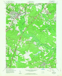
1957 Map of Laurel
USGS Topo · Published 1963About this map
The Patuxent River corridor serves as the central axis for this mid-century landscape, dividing the growing suburban centers of Laurel and Bowie from the expansive institutional holdings of the federal government. Massive tracts are dedicated to the U S Dept of Agriculture Research Center and the Fort George G Meade Military Reservation, creating a distinct pattern of concentrated residential development alongside wide-open research and military grounds. Cultural and educational landmarks include the Laurel Sanitarium, the Maryland State Teachers College, and the prominent Laurel Race Track near the Howard and Prince Georges county line. Local heritage is preserved in sites like Perkins Chapel, St Jacobs Cemetery, and Duckettsville, while the Baltimore and Ohio RR and Pennsylvania RR lines trace the historical transportation routes that shaped these communities.
Find a feature on this map
64 named features on this map. Tap any name to fly to it.
Don’t see what you’re looking for? This feature index may not catch every label — zoom into the map to look around manually.
Map Details
Editions of this 1957 Laurel Map
2 editions found
Other maps of this area

1892 · Laurel
USGS Topo · 1:62,500

1892 · Owensville
USGS Topo · 1:62,500

1894 · Laurel
USGS Topo · 1:62,500

1894 · Relay
USGS Topo · 1:62,500

1895 · Owensville
USGS Topo · 1:62,500

1897 · Laurel
USGS Topo · 1:62,500

1899 · Patuxent
USGS Topo · 1:125,000

1900 · Washington
USGS Topo · 1:62,500

1905 · Owensville
USGS Topo · 1:62,500

1906 · Patuxent
USGS Topo · 1:125,000